Lot
186
Lot 186
CANAL INTEREST: four maps depicting canal navigations, late ...
Hammer
£120
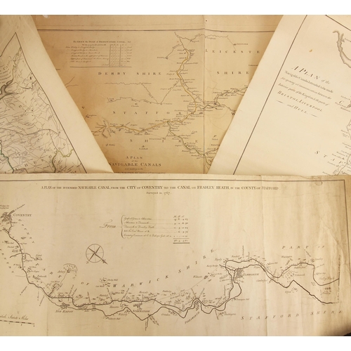
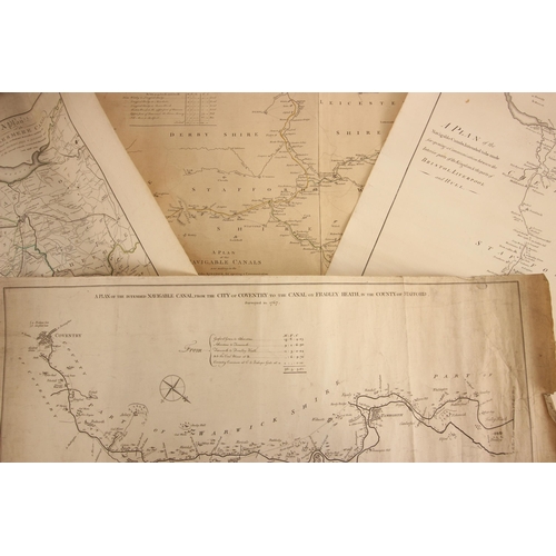
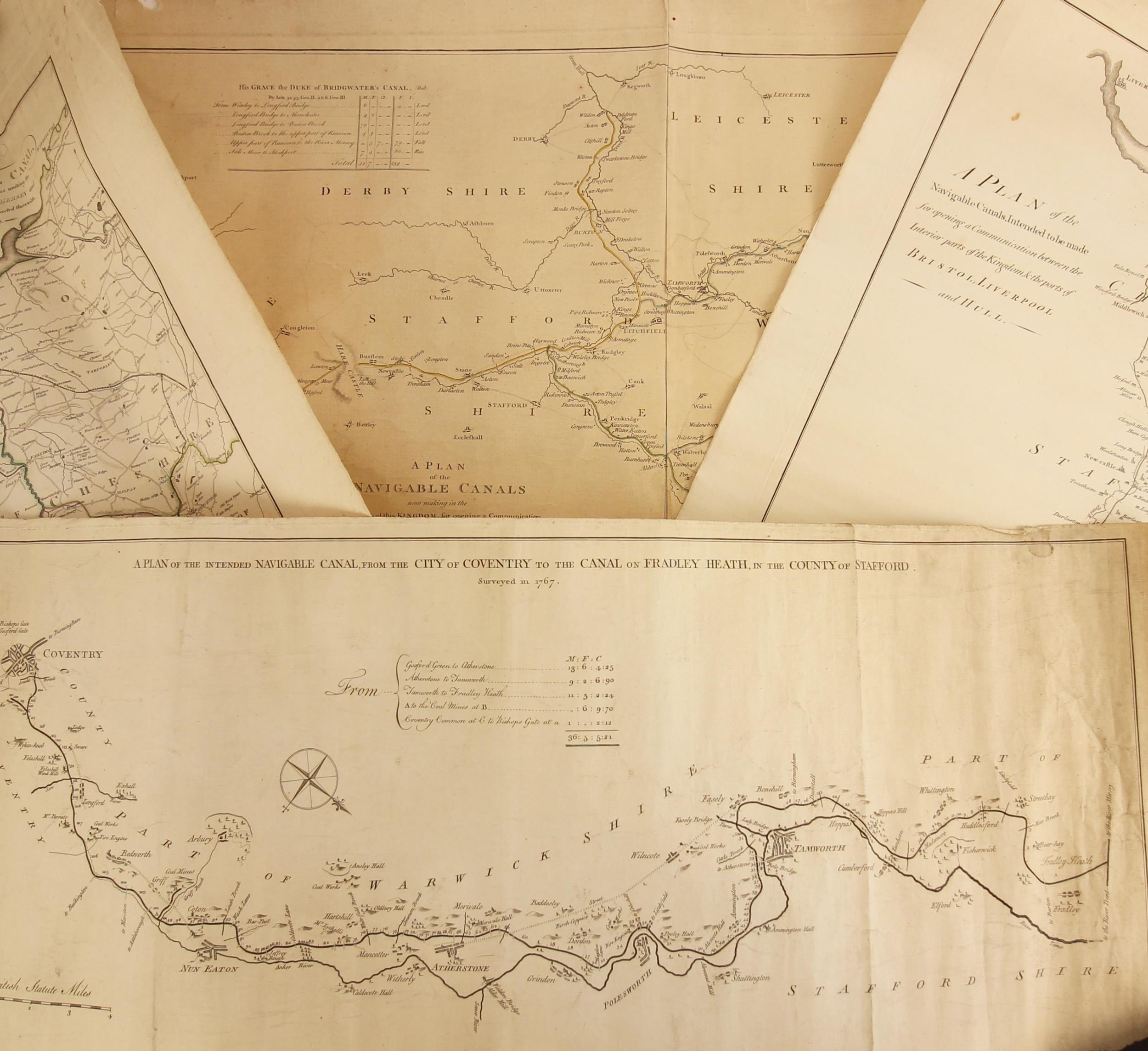
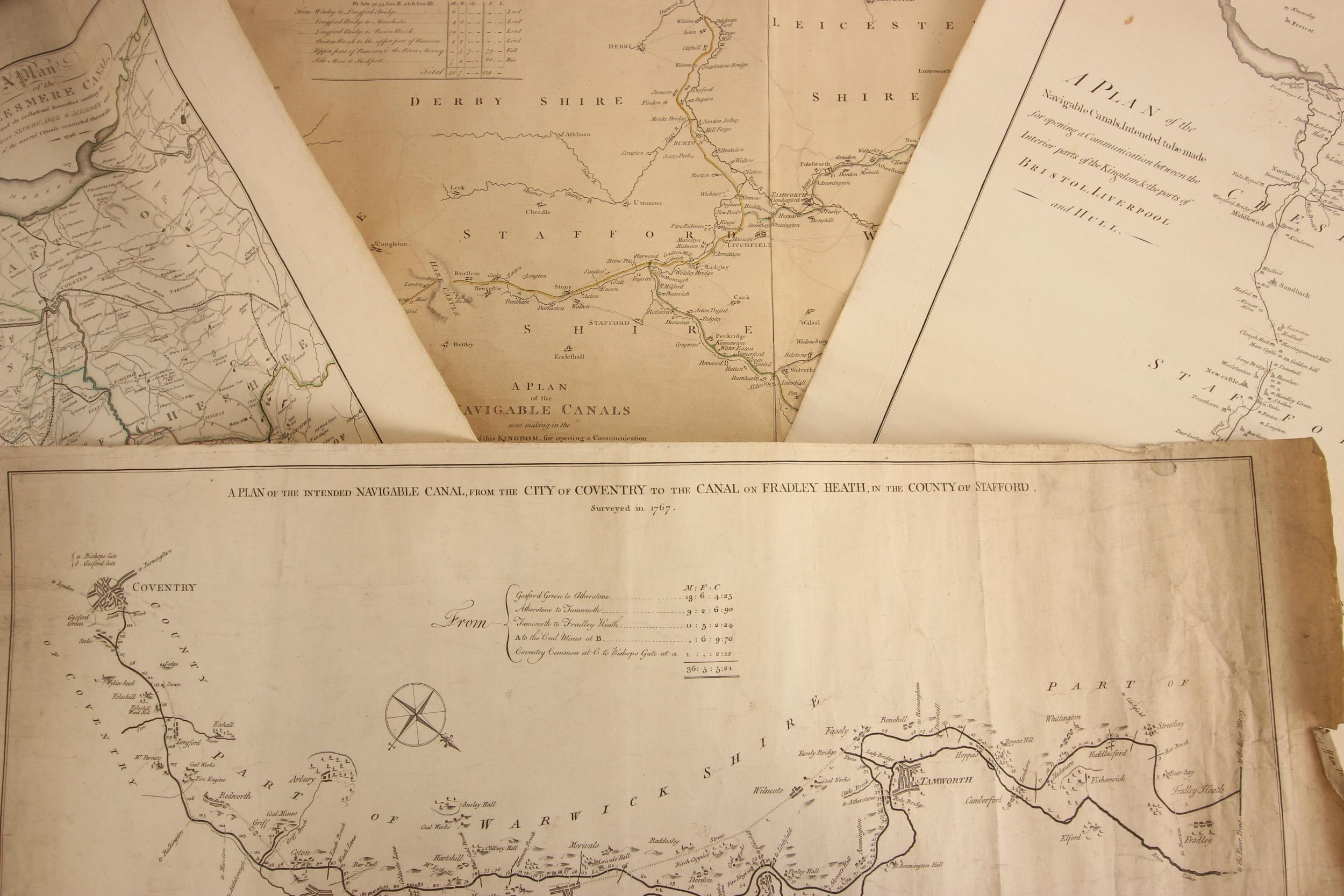
CANAL INTEREST: four maps depicting canal navigations, late 18th century and later, comprising: ‘A plan of the intended navigable canal, from the city of Coventry to the canal on Fradley Heath, in the county of Stafford Surveyed in 1767’, drawn by Robert Whitworth, engraved by Thomas Kitchin, laid paper, visible plate mark, 31cm x 78cm; ‘A Plan of the Navigable Canals, intended to be made for opening a communication between the interior parts of the kingdom & the ports of Bristol. Liverpool and Hull’, laid paper, visible plate mark, 60cm x 48cm; ‘A Plan of the Navigable Canals now making in the inland parts of this kingdom, for opening of communication to the ports of London, Bristol, Liverpool, and Hull, with the adjacent Towns and Rivers’, published for James Brindley, London 1769, laid paper, visible plate mark, 62cm x 88cm, and ‘A plan of the Ellesmere Canal and its Collateral Branches uniting the Rivers Severn. Dee & Mersey and of the several canals connected therewith’, visible plate mark, 35cm x 58cm, all unframed (4) (at fault)
Fees apply to the hammer price:
Room and Absentee Bids:
26.40% inc VAT*
Online and Autobids:
28.8% inc VAT*
Please see the auctioneers terms & conditions for more information
Other Lots in this Auction

Tel: 01948 800 202
The Joyce Building, Whitchurch, Shropshire, SY13 1RE.
© Trevanion & Dean Auctioneers, inc. All rights reserved.